News Summary
Tybee Island, Georgia, has partnered with the U.S. Army Corps of Engineers to study the wave impacts of larger vessels following the Savannah Harbor Expansion Project. The study, beginning March 21, 2025, aims to enhance beach safety and understand the relationship between vessel operations and environmental conditions. Using specialized instruments on North Beach, researchers will assess wave behaviors and work towards solutions to mitigate risks posed by these powerful maritime wakes, ensuring safer and more enjoyable beach experiences for residents and visitors.
Tybee Island Takes Action to Tackle Vessel-Generated Waves
Tybee Island, Georgia, is bracing itself for some serious science, thanks to a new study launched on March 21, 2025, by the U.S. Army Corps of Engineers’ Savannah District. Teamed up with the Engineer Research and Development Center and the Field Research Facility, the city is gearing up to gather data about waves created by vessels cruising in its waters. This exciting initiative aims to dive deeper into the choppy waters stirred up by those massive ships, especially after the recent Savannah Harbor Expansion Project opened the door to bigger Neo Panamax vessels.
Why the Concern?
With these larger vessels making their way through the region, beachgoers and city officials alike have grown increasingly anxious. The mighty wakes these ships create can lead to hazardous surges, posing risks to those enjoying the coastline. The goal of the study is crystal clear: enhance safety for everyone who loves North Beach.
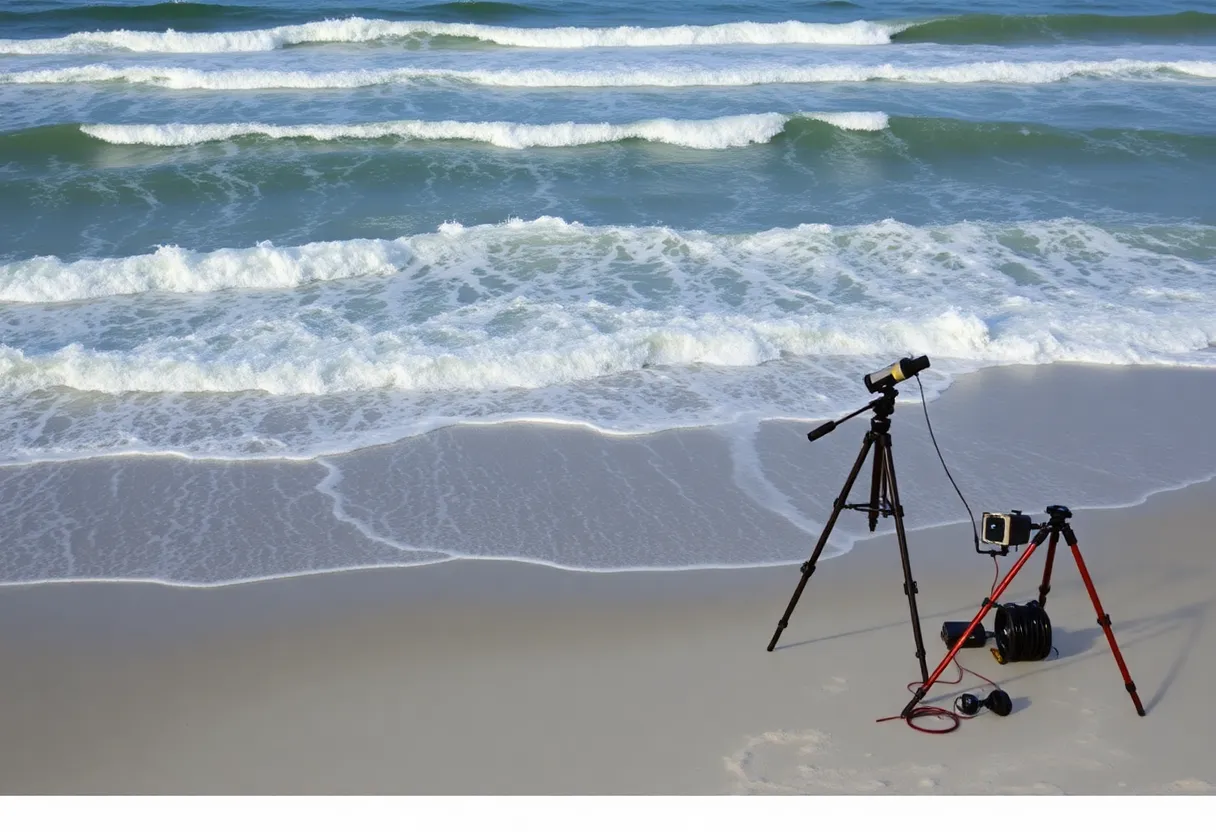
As part of the study, a group of specialized instruments has been set up on North Beach to assess how vessel operations relate to environmental conditions. By getting a better grasp on the height and behavior of these waves, researchers hope to pinpoint what makes some vessels create bigger wakes than others.
A Follow-Up on Previous Research
This current study is a follow-up to a prior research effort in 2021, which spotlighted some significant gaps in understanding long-term data from the surf zone. That earlier study revealed a high volume of cargo and tanker vessel passages—1,386 cargo passages and 202 tankers—and analyzed their relationship with wave height based on factors like size and speed. Costing around $350,000, it was funded collaboratively by both the U.S. Army Corps of Engineers and the city of Tybee. This new research is fully financed under the Monitoring Completed Navigation Projects Program, which is great news for Tybee!
Tech Tools of the Trade
What’s fascinating about this study is the kit of tools being utilized. Metal pyramid-shaped structures have been installed to measure water pressure and flow velocity. Meanwhile, a hydraulic lift equipped with cameras will keep a watchful eye on the ship channel and the beach, capturing pivotal data on wave height, speed, and approaching direction. Analyzing this information could lead the way to new models for predicting and mitigating risks tied to these powerful waves.
Waves and Erosion Troubles
The results of this research could pave the way for various potential solutions, from encouraging ships to slow down and refurbishing jetties to building nearshore breakwaters and tweaking the river channel itself. Beach erosion is another layer of complication here, with ongoing worries about how larger vessel wakes are contributing to the situation. Sand and sediment transportation are already dominant forces at work, and this research could provide valuable insight into how to shield Tybee’s beloved beaches.
What Next?
Current safety measures like increased signage and vigilant monitoring are already in place, and these efforts have led to a successful record for lifeguards—no rescues stemming from wake incidents in recent times. However, the local officials are not resting on their laurels. Ongoing coordination with the research team, given Tybee Island’s proximity—just 0.6 miles away—from the Savannah River navigation channel, is crucial as they strive for effective beach safety and preservation solutions.
Looking ahead, possibilities abound for further research, featuring simulation studies and channel realignment proposals. The ongoing partnership between local authorities, the U.S. Army Corps of Engineers, and the Georgia Port Authority embodies a collective commitment to keeping Tybee Island’s beaches safe, enjoyable, and beautiful. With this ambitious study underway, the islanders can look forward to a more secure coast for years to come!
Deeper Dive: News & Info About This Topic
HERE Resources
Additional Resources
- Savannah Business Journal
- Wikipedia: Coastal Erosion
- WSAV News
- Google Search: Tybee Island Beaches
- Savannah Now
- Encyclopedia Britannica: Water Wave
- Fox28 Savannah
- Google News: Ship Wakes Tybee Island


